Betty’s Neck
Set in the heart of the protected Assawompset Pond Complex in Lakeville, Betty’s Neck offers miles of secluded trails and expansive freshwater views. Known as a prime place to see bald eagles, this town-owned property is a beautiful spot for walking, fishing, geocaching, and wildlife watching any time of year.
Features
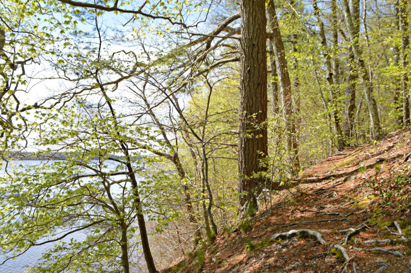
Hilly, wooded trails at Betty’s Neck lead to beautiful views along the shoreline of Assawompset Pond, where you might spot a bald eagle if you’re lucky!
Located in the middle of thousands of acres of protected land, Betty’s Neck is one of the few public places where you can access Assawompset Pond: the largest natural body of fresh water in Massachusetts. The ponds in this complex supply public drinking water for nearly a quarter-million people in southeastern Massachusetts, including New Bedford and Acushnet. (Because this land protects clean drinking water, there is no swimming, wading, or paddling allowed at Betty’s Neck.)
Once a core area of the Wampanoag region, today Betty’s Neck is a destination for locals to explore the outdoors. Take a lovely meadow walk in springtime, stopping for lunch at the picnic tables by the field’s edge. Or hike through the hilly forest to the pond’s quiet shoreline, where you can search the skies for bald eagles.
Trails
Betty’s Neck is home to roughly 3 miles of trails that snake through forests, past fields, and along the pond shoreline. To reach the parking area, follow the private cranberry bog access road from Long Point Road past Island Terrace until you see a marked rock welcoming you to Betty’s Neck. (Download trail map)
Starting at the parking area, walk down the path that leads along the edge of the field to the information kiosk next to the Peach Barn. From here, you can explore the Field Trail, a 1.5-mile loop around the perimeter of two fields. This is a relatively flat, easy trail that everyone can enjoy.
From the Field Trail, veer onto the White Blaze Trail or the Blue Blaze Trail to discover wooded paths that will take you toward the water. The White Blaze Trail is a .75-mile loop eastward to “The Narrows,” which connects Assawompset Pond with smaller Pocksha Pond. The out-and-back Blue Blaze Trail connects with the White Blaze Trail and leads a half-mile north to a spectacular pond view at Jeremy’s Point. These trails can be steep in places, so make sure you’re prepared before you begin your walk.
(A full print Assawompset Pond Complex map is available for purchase at the Lakeville Town Clerk’s office for $2.)
Habitats & Wildlife
Betty’s Neck is part of the Assawompset Pond Complex, a 4,000-acre area of land in Lakeville, Middleborough, Rochester, and Freetown. This land acts as a protective buffer for the ponds, which connect with the Acushnet River and the Mattapoisett River before ultimately flowing to Buzzards Bay.
With so much preserved land in this area, Betty’s Neck provides important habitats for wildlife, including some rare species. It’s one of the few places in southeastern Massachusetts where bald eagles nest, and the pond’s clean water supports vulnerable species of turtles, fish, and mussels. The presence of these rare species shows how beneficial it is to protect places like the Assawompset Pond Complex for both people and wildlife.
 Download Property Map