How to explore the Southeastern Massachusetts Bioreserve
The Southeastern Massachusetts Bioreserve is a treasure for outdoor explorers in the Buzzards Bay region. This vast swath of forests, streams, and wetlands is one of the largest unfragmented forests in eastern Massachusetts, conserving a special ecosystem that protects clean water and provides habitat for countless wildlife species.
The Bioreserve has something for everyone to enjoy, but its large size and relatively remote location can be a bit daunting. To help you discover this wonderfully wild place, we’ve gathered up the best tips, locations, and suggestions so you can explore the Southeastern Massachusetts Bioreserve.
Where is the Southeastern Massachusetts Bioreserve?
The Bioreserve stretches across 13,600 acres of Freetown and Fall River. Think of the Bioreserve not as a single place to go, but rather as a collection of places that create a network of protected land called the Southeastern Massachusetts Bioreserve.
For outdoor explorers, there are five main places to go within the Bioreserve. Each of these places has its own distinct character and purpose for conservation.
Freetown-Fall River State Forest
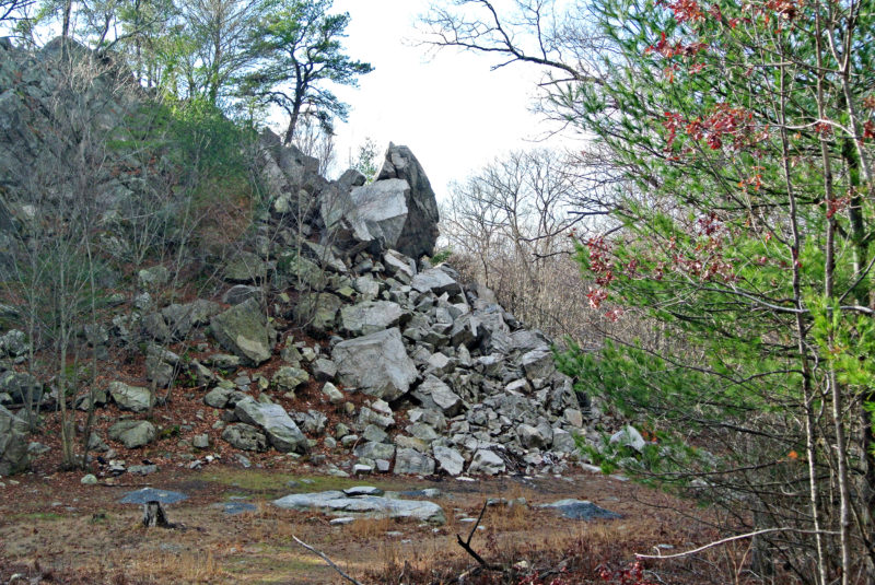
Popular Profile Rock is a family-friendly attraction to explore at Freetown-Fall River State Forest.
For a true adventure in the woods, head to Freetown-Fall River State Forest. With more than 5,000 acres to explore, this state forest covers the northern half of the Bioreserve along the Freetown/Fall River border.
Many people know Freetown-Fall River State Forest because of popular Profile Rock, a 50-foot outcropping that resembles a profile believed to be Chief Massasoit. The pavilions, picnic tables, and wading pool at the nearby forest headquarters are also a magnet for families in summer. Go beyond these attractions, and you’ll find a wild world to discover along the state forest’s seemingly endless trails.
Copicut Woods
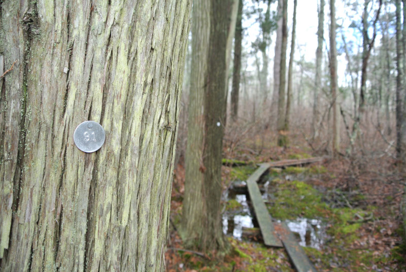
Discover an Atlantic cedar swamp at Copicut Woods in Fall River.
Although it’s located within the city limits of Fall River, Copicut Woods feels a world away from any urban area. The Trustees owns and manages this 516-acre property owned by The Trustees is a unique destination that displays the area’s natural ecological features and vibrant agricultural past.
At this southern gateway to the Bioreserve, you’ll find a peaceful natural retreat: towering trees, quietly flowing streams, and flourishing vernal pools. Raised boards lead you through a freshwater swamp, where Atlantic white cedars twist toward the sky. At the Isaac Miller Homestead – an abandoned farm settlement hidden in the woods – moss-covered stone walls and foundations bring local history into full view.
Watuppa Reservation
Once part of the nearby Wampanoag Reservation, the Watuppa Reservation is now owned and managed by the Fall River Water Division. This historically and ecologically significant land in the southwestern portion of the Bioreserve protects clean drinking water in North Watuppa Pond for city residents. With miles of trails through interior forest, Watuppa Reservation is a serene place to spot migrating birds and a secluded destination for hiking, mountain biking, and trail running.
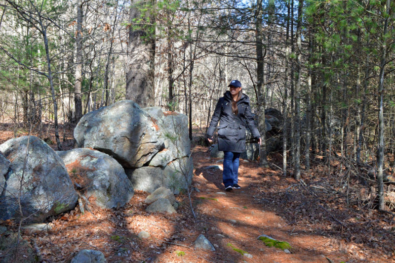
Discover old stone walls and quiet pine needle-carpeted paths at the Watuppa Reservation in Fall River.
Copicut Wildlife Management Area
Maintained by the state Department of Fish & Game, the Copicut Wildlife Management Area covers nearly 4,000 acres north of the Copicut Reservoir. This sprawling property is managed as fish and wildlife habitat; it’s home to an oasis of swamps and upland forests where birds and animals thrive. As a result, it’s known as an excellent spot for hunting for species like deer, turkeys, and coyotes. There are also more than five miles of trails here, but they’re minimally maintained – great for the experienced hiker or mountain biker looking for a quiet escape.
Ridge Hill Reserve
The Dartmouth Natural Resources Trust’s Ridge Hill Reserve is set along the edge of the Bioreserve in the Hixville area of Dartmouth. A portion of the reserve’s red trail (the Arabia Sampson Path) shares a boundary with Fall River Water Division lands that protect the Copicut Reservoir. Although you can’t access the reservoir from here, you can enjoy a view of it through the trees.
What can I do at the Southeastern Massachusetts Bioreserve?
From hiking, mountain biking, and cross-country skiing to hunting and fishing, there are endless possibilities for exploration at the Southeastern Massachusetts Bioreserve. The first thing you should do is download a Bioreserve map so you can see where to begin your exploration. (Freetown-Fall River State Forest and Copicut Woods also have their own trail maps that show those properties in more detail.)
When you set out to visit the Bioreserve, we recommend you use the map rather than a GPS to navigate the roads. Many of them are unpaved and unmaintained, and some have big potholes and bumpy surfaces. These “rough roads” are marked on the map with dashed lines. There are 14 designated parking areas sprinkled throughout the Bioreserve, with additional parking often allowed at roadside trailheads.
Each property within the Southeastern Massachusetts Bioreserve has a different owner, which means that each place has its own rules and regulations. For instance, dogs aren’t allowed at Watuppa Reservation and hunting is not permitted in most of Copicut Woods. But there are some general rules that apply to the entire Bioreserve, such as no camping, fires, or alcoholic beverages. Before you go, make sure to check the rules and regulations for the specific place you’re visiting to make sure the activities you want to enjoy are allowed there.
Hiking & Walking
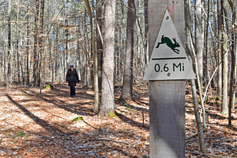
The Southeastern Massachusetts Bioreserve isn’t just for long hikes — try one of the easy self-guided trails, such as the Homestead Loop at Watuppa Reservation, which is marked with fun animal signs.
The Bioreserve is home to over 50 miles of interconnected trails and roads for hiking and walking. (We told you that map would come in handy!) Whether you want a casual walk with friends, a short jaunt with children, or a day-long wilderness hike, you’ll find a trail to explore at the Bioreserve. Each year, the Bioreserve hosts The Big Walk, an approximately 18-mile guided trek that showcases different trails.
On the map, you’ll see four “self-guided trails” marked in orange, which are ideal for an easy hike. Take a stroll down mile-long Miller Lane, an idyllic old carriage road at Copicut Woods lined with stone walls and draped with a canopy of trees. Or discover the Tattapanum Trail at Watuppa Reservation, where you can look for bald eagles on North Watuppa Pond.
If you want a little more adventure, then grab that map and chart your own hiking course. The map lists some of the Bioreserve’s most interesting features (marked by numbered diamonds), such as Profile Rock in Freetown-Fall River State Forest, Boiling Spring in Copicut Wildlife Management Area, and King Phillip’s Spring at Watuppa Reservation. Pack a lunch, and you can make a day of your Bioreserve exploration.
Mountain Biking
The Bioreserve is known as a mecca for mountain biking in southeastern Massachusetts. It even plays host to an annual fall mountain biking race, the Freetown 50, which features 50 miles of challenging technical terrain. (For those who want a slightly shorter challenge, the race also includes 25- and 11-mile options.) The trails are rugged, remote, and technical – perfect for the experienced mountain biker. The New England Mountain Bike Association offers some great tips and ideas for mountain biking through the Bioreserve, including Copicut Woods and Freetown-Fall River State Forest.
Trail Running
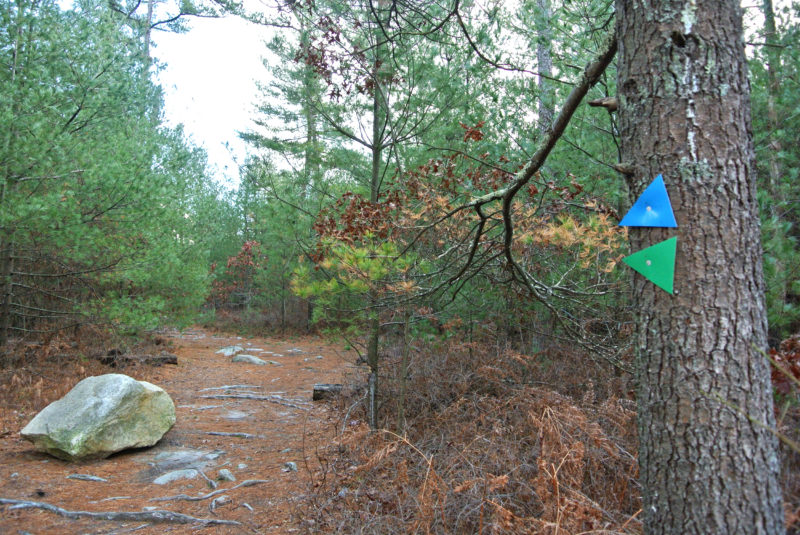
The extensive trails at Freetown-Fall River State Forest are marked by color, indicating allowed use.
With miles of wide, rolling fire roads, the Bioreserve is a great place to take a long, quiet trail run, particularly at Watuppa Reservation and the state forest. If you’re a runner, you won’t want to miss the annual Watuppa 10K, a race that helps fund trail maintenance at Watuppa Reservation.
Dog Walking
Dogs are welcome throughout most of the Bioreserve – with the exception of Watuppa Reservation, which protects drinking water supplies. Leashed dogs will enjoy a walk along the paths at Copicut Woods, while more energetic dogs can run and play (under voice control) in the state-owned lands.
Freshwater Fishing
Fall River’s protected watershed lands also include the area around Copicut Reservoir, which is open to shore fishing. (Because the reservoir serves as the city’s secondary drinking water source, boating and wading are not allowed.) In Freetown-Fall River State Forest, head to Rattlesnake Brook, which is stocked with trout each spring.
Hunting
Hunting is allowed throughout much of the Bioreserve. In particular, the Copicut Wildlife Management Area provides excellent hunting opportunities for white-tailed deer, eastern coyote, wild turkey, and numerous furbearer species. If you’re visiting any part of the Bioreserve during hunting season, make sure to wear blaze orange so you’re visible to hunters.
Birding & Wildlife Observation
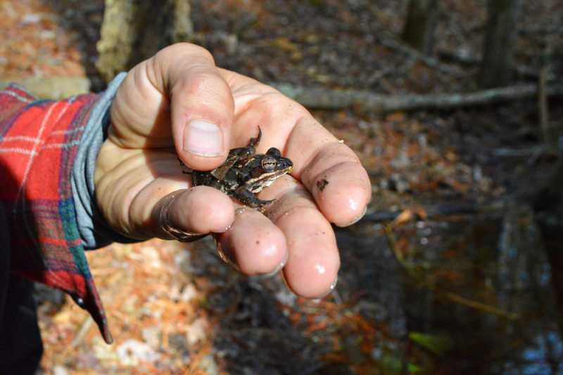
Look for frogs and salamanders among the Bioreserve’s many swamps and vernal pools.
As one of the largest unfragmented forests in eastern Massachusetts, the Bioreserve protects a special ecosystem that provides habitat for countless wildlife species. Nearly 100 birds breed among the Bioreserve’s deep forests, rare Atlantic white cedar swamps, and clear freshwater ponds and streams. In spring, listen for the distinctive calls of spring peepers and wood frogs, which breed in the Bioreserve’s numerous vernal pools.
Horseback Riding
Miles of bridle trails weave through Freetown-Fall River State Forest, the Bioreserve’s primary destination for horseback riding. If you’re on a mountain bike and you encounter visitors on horseback, be sure to announce yourself to avoid startling horses.
Winter Activities
For snow lovers, Freetown-Fall River State Forest is a play land for skiing, sledding, and snowshoeing. In fact, the trail map advises visitors to “yield to sleddogs” – a unique sight for southeastern Massachusetts!