How to explore the Assawompset Pond Complex
Take in woodland tranquility and abundant water views within the Assawompset Pond Complex, a system of conservation lands around five freshwater ponds in Lakeville, Middleborough, and Rochester.

Take in woodland tranquility and abundant water views within the Assawompset Pond Complex, a system of conservation lands around five freshwater ponds in Lakeville, Middleborough, and Rochester. This area is named for Assawompset Pond, the largest body of fresh water in Massachusetts. Offering stunning vistas and extensive trails over roughly 10,000 acres, you’re destined to find something to love about this complex’s wooded swamps, ponds, forests, and waterfronts.
The Assawompset Pond Complex can be confusing to explore, as it spans a patchwork of private lands located next to public access sites. To help you discover this area, we’ve gathered up its publicly accessible parks and trails, as well as the best tips and suggestions for taking an adventure. No matter how you choose to enjoy it, this charming area rewards explorers with outstanding natural beauty.
What is the Assawompset Pond Complex?
Located on the line between Plymouth and Bristol Counties, the complex is composed of Assawompset Pond, Pocksha Pond, Great Quittacas Pond, Little Quittacas Pond, and Long Pond. Of these six, Long Pond is the only body of water in the complex open to public recreation. Assawompset Pond and Long pond are the two largest natural freshwater bodies in Massachusetts, and provide drinking water to nearly a quarter million people. In addition, these lands are highly significant for the Wampanoag Tribe.Much like the Southeastern Massachusetts Bioreserve, the Assawompset Pond Complex isn’t so much a single place to visit, but rather a network of protected lands. Each site offers a different set of recreational activities, from picnicking to fishing to hiking. You can pick just one that fits your favorite way to get outside, or return again and again to explore them all. (A full print Assawompset Pond Complex map is available for purchase at the Lakeville Town Clerk’s office for $2.)
Where can I explore in the Assawompset Pond Complex?
[youtube]https://www.youtube.com/watch?v=dRqHuIDITs4[/youtube]New Bedford Waterworks
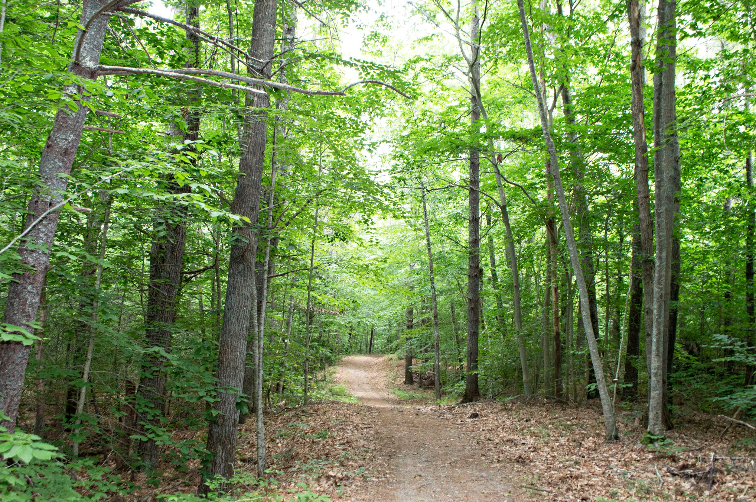
Located along North Avenue in Rochester, the trails and beautiful water views at New Bedford Waterworks welcome explorers of all ages. You can walk, bike, ski, or snowshoe the property’s wide, meandering fire roads and wooded paths. Multiple views of Great Quitticas Pond are visible along the trail offering openings, inviting you to stop and enjoy the freshwater scenery. As you sit by the shores of Great Quittacas Pond, it’s easy to imagine Wampanoag Tribe members paddling along the principal water route they established here, which connects Cape Cod Bay to Narragansett Bay.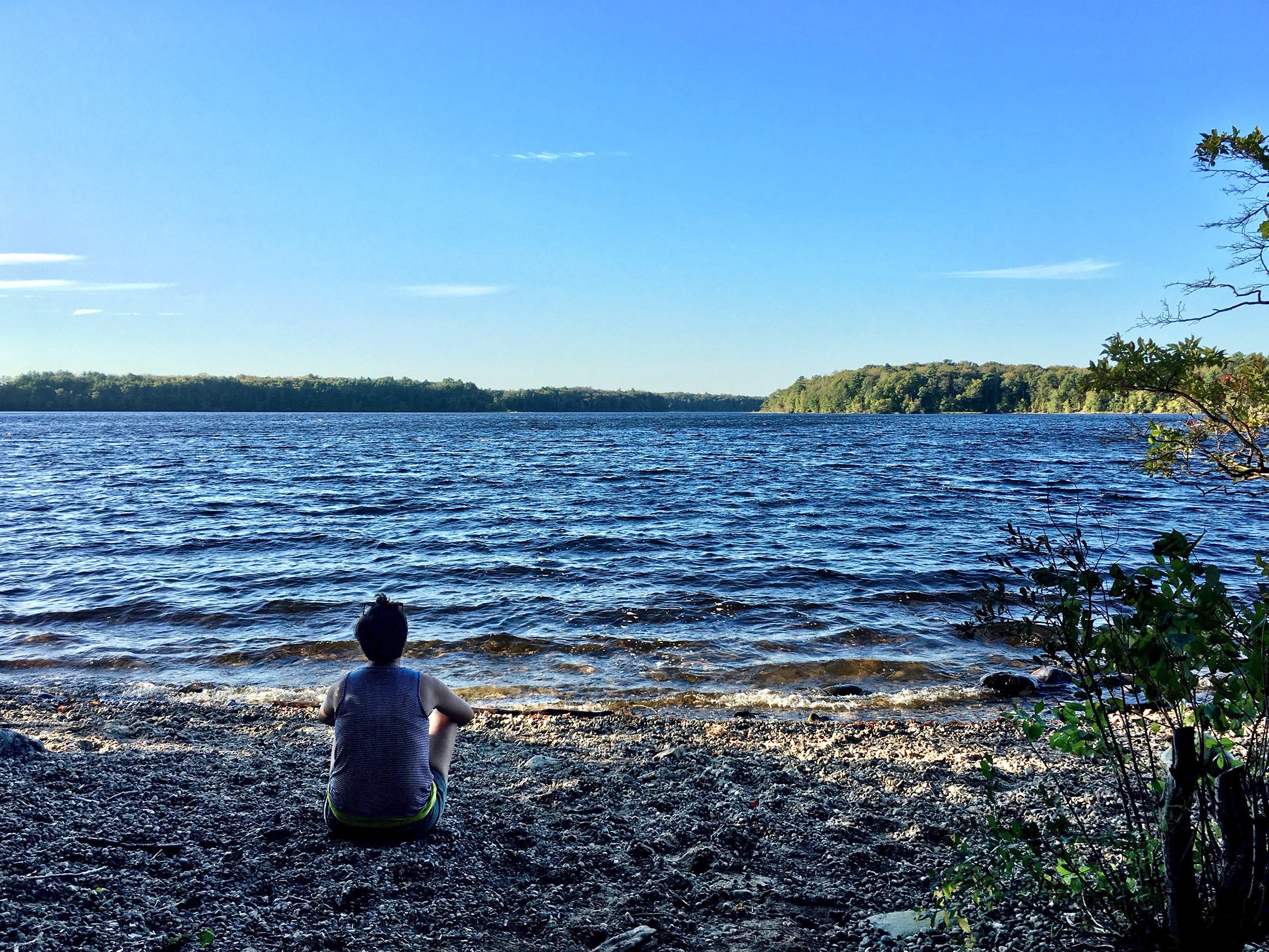
We recommend starting on the New Bedford Waterworks trails from gate R10, located next to easy parking at the North Rochester Congregational Church. You can access an array of woodland trails here, including the Tinkogkukquas Trail, which leads to Great Quitticas Pond. Because these trails are not marked, be sure to bring a printed or digital version of the trail map with you to navigate.
Tamarack Park
Located on Bedford Street in Lakeville, Tamarack Park is a great place to pack a picnic, relax in the green meadow, and take in the tranquil views of the Assawompset Pond. Once an old restaurant property, the park is now owned by the Lakeville Conservation Commission, and highlights native species of flowers and birds. If you want to spend some time out on the water, you can launch a kayak or canoe into Long Pond at a small launch leading into a marsh directly behind the parking area.Betty’s Neck

Betty’s Neck is home to roughly three miles of trail that winds through forests, past fields, and along the shoreline of Assawompset Pond. This town-owned property is a beautiful spot for walking, fishing, geocaching, and wildlife watching any time of year. Take a lovely meadow walk in springtime, stopping for lunch at the picnic tables by the field’s edge. If you’re up for a longer hike, follow the trail network through hilly forests to the pond’s quiet shoreline, where you can search the skies for bald eagles.
The ponds in this complex supply public drinking water; therefore, there is no swimming, wading, or paddling allowed at Betty’s Neck.
Long Pond Boat Ramp
For a fantastic day of freshwater fishing, launch your boat or kayak into Long Pond, a shallow pond covering 1,721 acres — making it one of the largest natural ponds in Massachusetts! A large paved boat ramp on the southeastern end of the pond, off Route 18 in Freetown, provides a convenient space to launch boats large and small. Ample parking space makes this a great place to get out on the water even in the busiest of summer months.Anglers will find that Long Pond has especially good fishing for largemouth bass, as well as white and yellow perch. Although there are no restrictions on speed or boat size in this pond, boaters should watch out for numerous submerged rocks. Boaters should also be cautious of swimmers, as Long Pond is the only place in this complex that permits swimming.