Howard Tinkham’s family has lived by the Mattapoisett River for so many generations that area maps call this part of Mattapoisett “Tinkhamtown.” His family land – 100 acres of thriving forests along a half-mile stretch of the river – protects drinking water for thousands of local residents. By working with the Buzzards Bay Coalition to preserve his forests, Tinkham is preventing these woods from ever being built upon.
Conserving land like Tinkham’s helps protect clean water in Buzzards Bay. Across our region, the Coalition has forever protected more than 10,000 acres of land in some of the Bay’s most special places. Without saving forests, streams, and wetlands, the Bay – its clean waters, scenic beauty, coastal habitats, and our quality of life – cannot survive.
Why is it important to protect land?
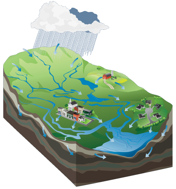
A watershed is the area of land that drains to a body of water. Everything we do on the land in the Buzzards Bay watershed can affect the health of our water, even if we live miles away from the coast.
Conserving land is one of the most important ways to protect clean water in Buzzards Bay. Our forests, streams, and wetlands work together to shield the Bay from harmful pollution. When we conserve land, we are saving the essential parts of the Bay ecosystem so it remains healthy for generations to come.
This land is called the Buzzards Bay watershed: the 432-square-mile area that drains to the Bay. All of the ponds, streams, and rivers that flow through the watershed eventually lead to the Bay. Everything we do on the land affects the health of our harbors, coves, and rivers – even if we’re miles away from the coast.
But land conservation isn’t just about the Bay. It’s about safeguarding clean drinking water, protecting fish and shellfish, and providing us with places to get outside and explore. And it’s about preserving the sense of place we all treasure here on Buzzards Bay by conserving the unique character and spectacular beauty of our communities.
Clean water
Forests and wetlands offer the best protection against nitrogen pollution: the greatest long-term threat to the health of Buzzards Bay. These natural areas are powerful pollution filters that absorb nitrogen before it can reach our waterways.
Land conservation also preserves our drinking water supplies. Many communities pull their public drinking water from ponds, lakes, and groundwater. By conserving land in places like the Assawompsett Ponds and the Mattapoisett River valley aquifer, we’re safeguarding clean drinking water for thousands of local residents.
Fish and wildlife habitats
Buzzards Bay’s fish, shellfish, and wildlife depend on clean water and healthy habitats. Large tracts of forest give birds and mammals places to nest and breed. Trees along streams help keep the water cool for sensitive fish and amphibians. Salt marshes buffer quahog beds from polluted runoff and create rich nursery grounds for fish and shellfish.
One shining example is Nasketucket Bay in Fairhaven and Mattapoisett, where hundreds of acres of forests, fields, and salt marshes have been protected. As a result, Nasketucket Bay is one of Buzzards Bay’s healthiest coastal waterways, with lush underwater eelgrass meadows and abundant fish, shellfish, and wildlife.
Outdoor recreation
Conserving land gives us more special places to explore, like this forested trail at Douglas S. Westgate Conservation Area in Wareham.
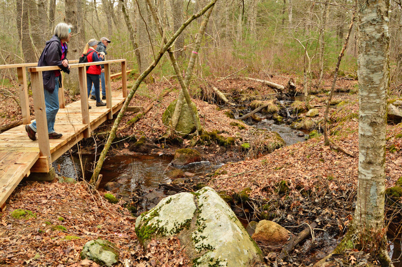
Think about your favorite place to go hiking, swimming, fishing, or paddling. The special places we love to explore have been protected – not just because they preserve critical habitats, but because they provide people with access to the outdoors. As we conserve more forests, streams, salt marshes, and beaches, people like you will have new places to discover on foot, bike, or boat.
What types of land are most important to conserve?
You can’t have clean water and thriving fish and wildlife populations without healthy forests, stream buffers, and wetlands. These natural filters provide the biggest benefits to Buzzards Bay.
As development has increased in our region, it’s become more important than ever to protect these lands. Poorly planned sprawling development means fewer forests, stream buffers, and wetlands and more paved roads, parking lots, and manicured lawns – all of which can harm the Bay’s health.
Forests
Compared to other East Coast estuaries like Narragansett Bay, the Chesapeake Bay, and Long Island Sound, Buzzards Bay has one important difference: large areas of forests. That’s one of the key secrets behind the Bay’s relative good health compared to these other waterways.
Forests protect clean water in countless ways. The rich soil in forests captures rainfall, filtering out harmful pollution before slowly releasing it into streams and groundwater. The roots of plants and trees hold soil in place, which prevents erosion. Trees help keep our air clean and cool, and shade streams where native brook trout live. Forests also provide habitat for wildlife and a place for people to escape to nature.
Stream buffers
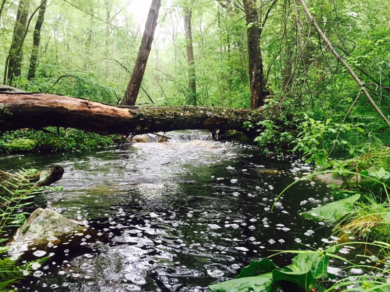
Forested buffers along streams like Angeline Brook in Westport work hard to protect clean water. They also help keep the stream cool, which is critical for sensitive fish like native sea-run brook trout.
There’s a particular type of forest that works hardest at protecting clean water: stream buffers, which are the forested areas that grow along streams. The first 200 feet of trees and plants along either side of a stream are the most important to protect.
More than 700 miles of streams flow through our watershed into Buzzards Bay. The forests that grow along these streams capture, absorb, and remove an amazing amount of pollution before it can reach our waterways – places where river herring swim, where quahogs grow, and where our children play.
Unfortunately, nearly one-third of the watershed’s stream buffers have been lost to development. It’s in those critical 200 feet where many want to live and work. As homes, farms, and commercial buildings replace natural stream buffers, the health of our water suffers.
Wetlands
Wetlands are low-lying places like salt marshes and wooded swamps that are naturally wet. These rich habitats are powerful pollution filters that can absorb as much as 90% of the nitrogen flowing across the land from nearby development. They also provide habitat for wildlife and protect our homes from flooding.
Despite layers of laws that are supposed to protect wetlands, Buzzards Bay continues to lose roughly 20 acres of wetlands to development every year.
Stunning examples exist everywhere – like this one on Eel Pond in Mattapoisett, where manicured lawns now cut deeply into buffer zones where wetlands were supposed to have been left untouched. Overall, 40% of the Bay’s original wetlands have been filled, drained, or built upon.
With climate change, wetland protection is more urgent than ever. The salt marshes that fringe our coastline and filter out pollution also protect our homes, beaches, and businesses from rising waters. As sea levels increase, protecting wetlands builds the Bay’s resilience against climate change.
How does the Coalition protect land?
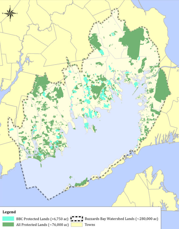
This map shows all of the land that has been protected in the Buzzards Bay watershed since 1998 (click to download full version).
The Buzzards Bay Coalition manages the largest land conservation program in southeastern Massachusetts. Since 1998, we’ve forever protected more than 10,000 acres of land across the region – an area nearly the size of the town of Fairhaven.
We focus on the land that’s most critical to protecting clean water: drinking water aquifers, pollution-sensitive harbors and coves, forested rivers and streams, and beaches and salt marshes along the Bay’s stunning shoreline. We also restore streams and wetlands that have been damaged by poorly planned development.
But pressure to develop Buzzards Bay’s forests, salt marshes, and stream buffers keeps growing. Unless we boost the pace of conservation, the Bay’s clean water, coastal habitats, and scenic beauty won’t survive. That’s why we’re constantly working to increase the amount of land we protect every year.
The Coalition uses all available tools to conserve land. In some spots, we purchase land outright or acquire the development rights on private lands. In others, we work hand-in-hand with towns and local land trusts to protect forests, farms, and wetlands in every corner of our watershed.
Acquiring land and conservation restrictions
Some places are so important to Buzzards Bay that the only way to truly protect them is to purchase them. Many of the vital links in the Bay ecosystem – forests, stream buffers, salt marshes – won’t be preserved unless we acquire them for conservation.
Along the Acushnet, Mattapoisett, and Weweantic rivers, we’ve purchased land to create growing river reserves that preserve clean water, important habitats, and outdoor recreation. At the Mattapoisett River Reserve, more than 200 acres protect an underground aquifer where thousands of local residents get their drinking water. And in the Acushnet River Reserve, we continue to acquire forests and wetlands along this long-neglected urban waterway.
We also hold voluntary land protection agreements called conservation restrictions on thousands of acres of private property across the watershed. These legal agreements permanently protect private lands like woods, farms, and cranberry bogs from development. For instance, on Nasketucket Bay, we worked with local landowners in Fairhaven and Mattapoisett to preserve more than 400 acres of coastal farmland and forests – the largest land conservation project on Buzzards Bay in 25 years.
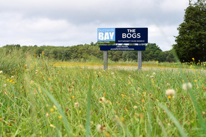
At the Mattapoisett River Reserve, more than 200 acres of land protect an underground aquifer where thousands of local residents get their drinking water.
Supporting local towns and land trusts
The Coalition actively supports local land trusts and municipalities that are conserving land in their communities. By working together, we can save much more land than we ever could on our own.
This support takes many forms. Sometimes we help land trusts apply for grants or raise money. Other times, we become the driving force to negotiate with landowners and close deals. One key tool is our Bay Lands Revolving Fund, which provides loans that have aided in the protection of nearly 2,500 acres.
Whatever the need, the Coalition seeks to aid local land trusts and town committees to conserve land in every corner of the Buzzards Bay watershed. Through partnerships and creative solutions, we’ll continue to save the land that protects clean water for all.