Land Purchases Key for Protection of Drinking Water in Rochester, Dartmouth
The Coalition made land and conservation restriction purchases with towns to protect the Paskamansett and Mattapoisett River watersheds.

The Mattapoisett River Valley, spanning from Snipatuit Pond in Rochester to Mattapoisett Harbor, is one of Southeastern Massachusetts’ most important water resources. Over the last quarter century, the Mattapoisett River Valley Land Protection Partnership between the Coalition, the towns of Marion, Rochester, Mattapoisett, and Fairhaven, and the MRV Water Supply Protection Advisory Committee has protected thousands of acres of land to maintain the quality and quantity of the region’s drinking water supply.
In late May, the Coalition purchased a 33-acre farm in Rochester and helped secure a $350K state grant that would allow the town of Marion to purchase a conservation restriction (CR) on it. That farm is less than 250 feet away from the Branch Brook Headwaters and less than 3,000 feet from a Marion town well (#5). The towns of Fairhaven and Mattapoisett also have town wells in the vicinity and the Town of Rochester draws from the Marion well mentioned.
In addition to protecting a highly valuable drinking water supply, the land will provide passive recreation opportunities and provide habitat for rare species.
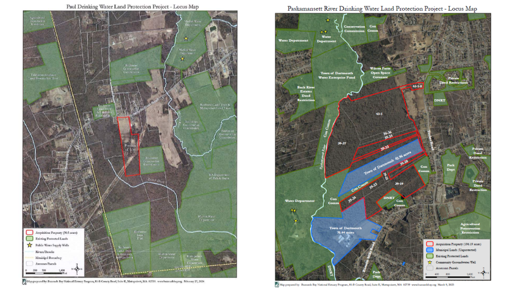
The Coalition also helped the Town of Dartmouth Water Department buy a large swath of land, most of which borders the Paskamansett River, from the Cornell family. We had secured funding from the state ($350K), the Town’s Community Preservation Fund ($250K). and an additional $200K in private funds. The town now owns the land, and the Coalition recorded a conservation restriction, which permanently protects the property.
The Paskamansett River Drinking Water Land Protection Project protects nearly 200 acres of open land over a critical public drinking water supply aquifer and remove an existing gap in the growing assemblage of protected land along the river. It is part of a strategy to increase protected lands in the Paskamansett River Valley, a key source of Dartmouth’s public drinking water.
The project acreage is located directly across the Paskamansett River from existing town Water Department lands (containing three groundwater pumping wells) and abuts other lands protected by the Dartmouth Conservation Commission and Dartmouth Natural Resources Trust.
Like the Branch Brook Headwaters land, this will provide appropriate public access for compatible passive recreation opportunities, have significant benefits to existing critical wildlife habitat, and protect water quality and aquatic habitat in the river and the downstream estuary.
The project property consists of eleven parcels of land in the area between the Paskamansett River and Tucker Road (a well-travelled road connecting to the commercial corridor of US Route 6 to the north) and includes 3,320 linear feet of direct frontage on the river, important wetland areas and forest.
The project boundary lies some 1,600 feet from one Dartmouth Town Public Supply Well; two more are not that far away.
For more on the Coalition’s collaborative efforts to protect the Mattapoisett River Valley, go here.
For more on the origins of the Coalition's collaboration with the Town of Dartmouth to protect these 196 acres along the Paskamansett River, go here.