Gooseberry Impact Report Finds Causeway Not Responsible for Shoreline Changes
Scientists found that the Gooseberry Causeway is not affecting the flow of water to the Westport River or its water quality and is not causing or accelerating erosion at East Beach.

Due to long-held concerns that the Gooseberry Causeway and other human modifications were affecting the Bay shoreline and the flushing of the Westport River, the Buzzards Bay Coalition convened a team of scientists in 2022 to understand how this human structure interacts with the land and water around it, namely its effects on the beaches and water quality of Buzzards Bay between the Westport and Slocums rivers.
The comprehensive report used historic measurements, a rigorous two-year field campaign, and cutting-edge computer modeling technology to assess whether changes to the shoreline are due to the causeway or not.
The scientists, from Boston University, Woods Hole Group, and Virginia Institute of Marine Science, found that the Gooseberry Causeway is not affecting the flow of water to the Westport River or its water quality, and it is not causing or accelerating erosion at East Beach.
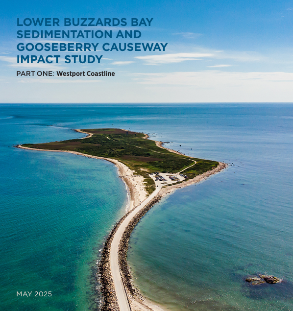
Part 1: Westport Coastline has been released. Part 2: Dartmouth Estuaries will be released by the end of the year.
History of the Causeway
A little over a hundred years ago, a sandbar walkable at low tide joined Gooseberry Island to the Westport mainland. In 1922, a simple causeway was built that was destroyed in the Hurricane of 1938. In 1943, the US Army established a WWII installation on the island and built a fortified causeway of boulders and concrete that remains to this day.
Now referred to as Gooseberry Neck, the combined causeway and island extend approximately one mile into Buzzards Bay.
The timing of Gooseberry Causeway construction coincides with a period of dramatic changes to this stretch of coastline, leading many government officials, coastal scientists and residents to question whether this manmade construction may be contributing to some or all of these issues.
Findings
Gooseberry Island itself creates the counter-clockwise circulation pattern that affects the flow of water to the mouth of the Westport River. The circulation pattern would be the same with or without the Causeway.
East Beach erosion would be occurring with or without the presence of the Causeway.
Under climate change scenarios, the causeway still will not strongly influence sediment transport in the region. Models show that deeper water due to sea level rise will move the circulation cells closer to the beach resulting in more erosion/transport throughout lower Buzzards Bay. More storms mean more frequent events when the waves are big enough to move large amounts of sand.
An overview of the report providing more details on these findings can be found here.
The entire report can be found here: Hughes, Z., FitzGerald, D., Fagherazzi, S., Asik, T., Xie, D., Tas, S., Hein, C., Dongen, A., Shultz, M. (2025) Lower Buzzards Bay Sedimentation & Gooseberry Causeway Impact Study; Westport River Inlet and East Beach; Results Report 1. 96 pp.


