Using Fire to Improve Habitat, Protect Homes on Cuttyhunk

Firefighters monitor the prescribed burn on Cuttyhunk
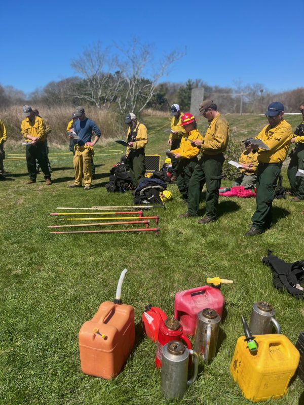
Buzzards Bay Coalition staffers Jack Sidar, Craig Willey, Mary Doucette and Adam Seablom stand with a team of about thirty firefighters. They have gathered around five vehicles just below where a paved Tower Road ends at the radio tower for which it is named. This tower, a good way to get your bearings from anywhere around it, is built upon the highest elevation on this small Elizabeth Island bordering the south side of Buzzards Bay. Since preserving more than 200 acres on Cuttyhunk between 2020 and 2022, the Coalition has been stewarding the land, which includes organizing this burn to improve wildlife habitat and protect the town from wildfire.
There are two modest-sized Cuttyhunk fire engines, two pickup trucks with tanks of water, and a single all-terrain utility vehicle with its own water tank. A few are still topping off their tanks from a nearby fire hydrant. There are two teams—each with an engine and a truck and crew on foot with tools and a drip torch—which stay along the fire breaks and create protective lines of black along the borders. Another smaller “ignition” team is responsible for starting the burn from the interior of the parcel (or unit).
Typically, before a prescribed burn takes place, the “burn boss”— in this case Mass Wildlife’s Alex Enrup—delivers one final briefing before everyone mans their starting positions. His audience consists of the Buzzards Bay Coalition staff, Mass DCR Bureau of Forest Fire Control and Forestry, others from MassWildlife, and the Town of Gosnold Fire Department. A few firefighters from West Barnstable are in attendance as well to assist.
Enrup reviews one last time the intention of the burn and what the team can expect to do to slow down the fire should its start moving too fast and the best ways to extinguish spot fires. Winds are light from the northwest, but he said that they should be shifting in the afternoon to southwest winds; there aren’t any clouds in the sky, so “we’ll have to pay close attention” to any tell-tales, natural and man-made. Smoke might get up a couple thousand feet, but due to the relative low-lying brush the flame length should be minimal. “Watch for low vines, which can be tripping hazards,” he warns.
The team all has maps with drop points. Everyone knows where they will begin and new instructions will be relayed over radio as the first unit’s burn is winding down. The ignition and holding team lines up at the property line of an island residence. Others head to the high ground and disperse down paths to their positions, while others remain at the end of the road, where you can see the expanse to be burned, a portion of the western slope of the island. As you look beyond that point, the end of the chain of Elizabeth Island, only water is visible.
A group of firefighters listens to burn boss Alex Enrup of MassWidlife
Pretty soon, the sound of crackling brush alerts the team that this long-awaited prescribed burn has begun. The fire moves slowly, well in control. It burns leafless wood. Smoke rises into the air, as a distinctive smell hits one’s nostrils. The fire thrives in some areas but dies in others, based on the amount of brush to keep it going. Occasionally, it lights up a scrub pine and everyone, including some townspeople who have come to watch, get a little show for a few seconds.
The team plans to burn about 30 acres. This will decrease the amount of brush (fuel) in the area to keep a wildfire from spreading through the unpopulated area and raging toward the town. It is meant to maintain this slope as maritime grassland—an important but declining habitat type in our region. This burn will not leave the area completely bare, but will reduce the growing brush that has not been curbed since the town stopped doing regular burns decades ago. The Coalition has coordinated smaller burns the previous years (6 acres and 23 acres in 2023 and 2024, respectively), to make up the years in which land management didn’t take place.
The Coalition stewards the land of this burn. It owns half of it and the other half is on private land on which the Coalition has a conservation restriction. While we do annual mowing and mechanical thinning, controlled burns are required. Ecologically speaking, this burn promotes warm-season grasses, which are better habitat for birds such as sparrows, meadowlarks, American kestrels, and more, which in other places have been lost to development or forest succession.
Founding Coalition board member Seth Garfield is the Cuttyhunk Fire Chief. His face brown from many summers working outdoors on this exposed island, he lets Enrup take the lead as burn boss, although he and the Coalition staff know the area more intimately. He wears many hats on the island, including owning a landscaping company. He owned Cuttyhunk Oyster Farms for more than three decades. He is thankful that such a prescribed burn has been a stunning success on this day. And many of his fellow island residents feel the same way.
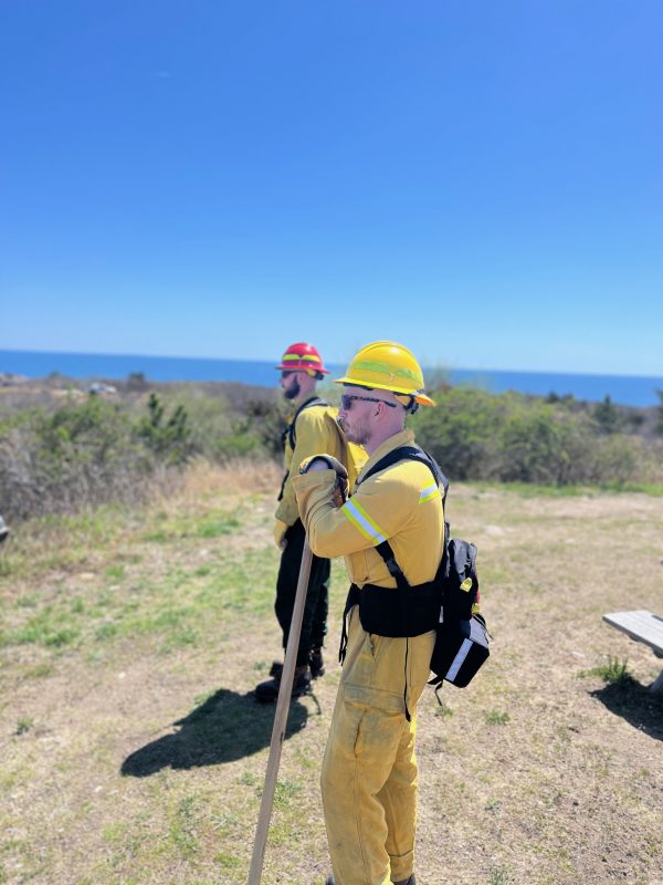
Jack Sidar and Adam Seablom monitor the fire during the burn at Cuttyhunk.